
OCTOBER 10 The Railroading History of Kaaterskill Junction: A Hike with Paul LaPierre
From publicly posted calendar Checked 4 hours ago
About this event
One of 5 upcoming events at MTHS.
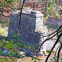
Hike along the old, mostly level railroad bed, about 4 miles long, exploring the area around Kaaterskill Junction on State Route 214. You will be stepping back in time to the days when the Kaaterskill and Stony Clove Railroad came up to the Junction from Phoenicia and then split to the west on the Hunter Branch and headed east on the Tannersville Branch toward the Hotel Kaaterskill. A track plan of the junction and photographs showing the several sidings that served the sorting of freight and passenger cars to the two branches will be provided, supported by rail ties that still remain 84 years after the abandonment of the line in 1940. To the east the hike will visit the remains of the Light Dam Bridge over the Schoharie Creek. A side excursion to the new Hunter Branch Rail Trail pedestrian bridge over a tributary of the Schoharie Creek will be added after returning to our start at the Junction site. Directions: Address: 4282 Rte 214 About a .4 mile south from the 23A end of Rte 214 on the left there is a sign planted in the grass marking the Junction —drive in and park on the U-shaped driveway. Registration is required. For more information or to register, please email [email protected] or call 518-589-6657. Hike Leader: Paul LaPierre Difficulty: Moderate